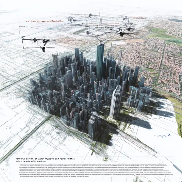
在数字孪生立体空间内,可以利用GIS技术
提示词:In the three-dimensional space of digital twins, GIS technology can be used for layering and classification, and visual expression methods can be used to delineate spatial boundaries. By using real-life 3D foundations and overlaying unsuitable flying spaces such as densely populated residential areas, it is possible to accurately delineate the available low altitude space in the city. By utilizing the data foundation and modeling methods of real-life 3D, and following the idea of "vertical layered differentiation function, horizontal division of management units, use of corridors within the same layer, and layout of multiple air routes within corridors", low altitude space can be finely and efficiently segmented and utilized, improving the efficiency of low altitude resource utilization. In the vertical direction, space layers can be divided according to the flight requirements of different aircraft, and can also be functionally divided into three categories: government law enforcement layer, public service layer, and socio-economic activity layer. In the horizontal direction, different grid benchmarks can be used for division, such as scale topographic maps, administrative divisions, Beidou grids, etc., which can strengthen the coordination and management of ground resources for low altitude flight --ar 1:1 --v 6.1 --stylize 100
素材来源:Midjourney中文版
Copyright©2017 Midjourney9.com All Right
Reserved 版权所有:成都金翼云科技有限公司 蜀ICP备2023008999号